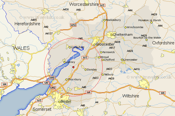
Gloucestershire Map Showing Location of Berkeley
Population: 1865
District: Stroud
Easting: 368892 Northing: 198429
Latitude: 51.68 Longitude: -2.45
 = Berkeley
District: Stroud
Easting: 368892 Northing: 198429
Latitude: 51.68 Longitude: -2.45
= Berkeley
This Berkeley map below is supplied by Google. Use the tools in the top left corner to zoom into street level or zoom out for a road map, you may also need to zoom in to see Berkeley on the map. Click and drag the map to move around. If the map fails to load try and refresh your browser or zoom in or out (+ or -).
Update - it seems Google no longer allow people to use their maps for free! This Berkeley map sometimes loads and sometimes gives a error. I am working on a solution.
Closest 30 Towns or Cities to Berkeley (Population over 500)
Stone 3.88km North Nibley 4.95km Falfield 5.56km Slimbridge 5.91km Lydney 6.84km Cam 7.14km Cromhall 7.41km Charfield 7.75km Dursley 8.25km Coaley 8.86km Wotton-under-Edge 8.86km Wotton under Edge 8.86km Uley 9.19km Awre 9.35km Tytherington 9.54km Thornbury 10.34km Woolaston 10.5km Alveston 10.9km Frampton on Severn 10.91km Frampton 10.91km Frampton-on-Severn 10.91km Bream 10.94km Wickwar 12.03km Rangeworthy 12.97km Newham 13.03km Newnham 13.03km Stonehouse 13.67km Olveston 13.73km Hawkesbury 13.73km Tidenham 14.28km