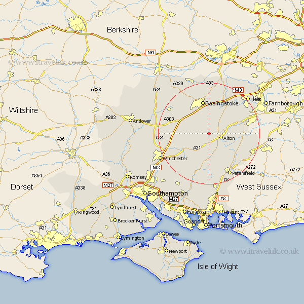
Hampshire Map Showing Location of Bentworth
Population: 466
District: East Hampshire
Easting: 466438 Northing: 139458
Latitude: 51.15 Longitude: -1.05
 = Bentworth
District: East Hampshire
Easting: 466438 Northing: 139458
Latitude: 51.15 Longitude: -1.05
= Bentworth
This Bentworth map below is supplied by Google. Use the tools in the top left corner to zoom into street level or zoom out for a road map, you may also need to zoom in to see Bentworth on the map. Click and drag the map to move around. If the map fails to load try and refresh your browser or zoom in or out (+ or -).
Update - it seems Google no longer allow people to use their maps for free! This Bentworth map sometimes loads and sometimes gives a error. I am working on a solution.
Closest 30 Towns or Cities to Bentworth (Population over 500)
Four Marks 3.7km Medstead 3.88km Alton 5.01km Upper Farringdon 7.25km Faringdon 7.25km Farringdon 7.25km Upton Grey 8.19km Dummer 8.92km Froyle 9.48km Ropley 9.55km North Waltham 10.83km Long Sutton 11.01km New Alresford 11.01km Selborne 11.02km Binsted 11.63km Basing 13.03km Basingstoke 13.18km Bentley 13.31km Kingsley 13.32km Odiham 13.77km Cheriton 13.78km Bramdean 13.79km Bordon Camp 14.44km Bordon 14.44km Oakley 14.49km Hook 14.73km West Meon 15km Froxfield 15.23km Micheldever 15.23km Greatham 15.28km