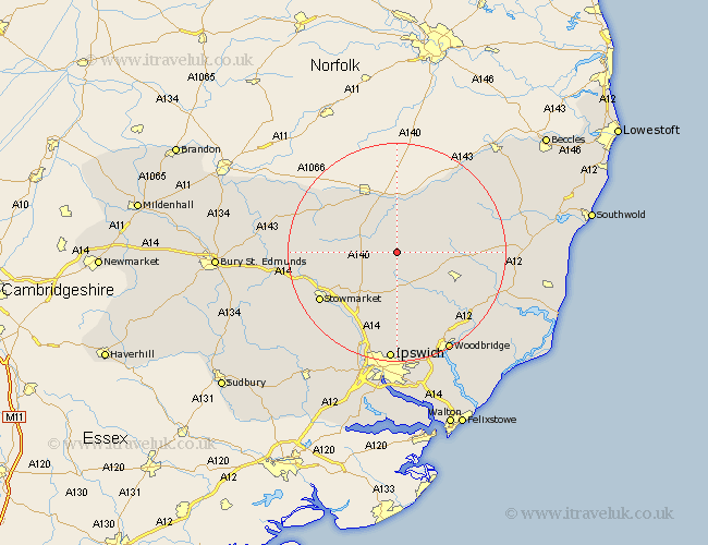
Suffolk Map Showing Location of Bedingfield
Population: 223
District: Mid Suffolk
Easting: 617187 Northing: 267988
Latitude: 52.27 Longitude: 1.18
 = Bedingfield
District: Mid Suffolk
Easting: 617187 Northing: 267988
Latitude: 52.27 Longitude: 1.18
= Bedingfield
This Bedingfield map below is supplied by Google. Use the tools in the top left corner to zoom into street level or zoom out for a road map, you may also need to zoom in to see Bedingfield on the map. Click and drag the map to move around. If the map fails to load try and refresh your browser or zoom in or out (+ or -).
Update - it seems Google no longer allow people to use their maps for free! This Bedingfield map sometimes loads and sometimes gives a error. I am working on a solution.
Closest 30 Towns or Cities to Bedingfield (Population over 500)
Thorndon 3.87km Worlingworth 4.54km Debenham 5.56km Eye 6.01km Stradbroke 7.94km Dennington 7.94km Mendlesham 8.15km Hoxne 9.33km Gislingham 9.8km Bacton 11.34km Framlingham 11.63km Fressingfield 12.19km Old Newton 12.64km Wortham 12.96km Laxfield 13.01km Otley 13.42km Botesdale 13.54km Haughley 14.71km Coddenham 15.51km Stowmarket 16.48km Redgrave 16.7km Henley 16.83km Wickham Market 18.01km Badwell Ash 18.24km Elmswell 18.53km Witnesham 18.54km Wirnesham 18.54km Cookley 18.97km Grundisburgh 19.09km Great Blakenham 19.39km