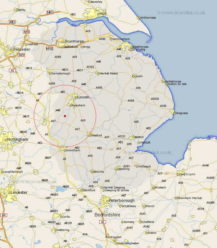
Lincolnshire Map Showing Location of Bassingham
Population: 1308
District: North Kesteven
Easting: 491458 Northing: 358629
Latitude: 53.12 Longitude: -0.63
 = Bassingham
District: North Kesteven
Easting: 491458 Northing: 358629
Latitude: 53.12 Longitude: -0.63
= Bassingham
This Bassingham map below is supplied by Google. Use the tools in the top left corner to zoom into street level or zoom out for a road map, you may also need to zoom in to see Bassingham on the map. Click and drag the map to move around. If the map fails to load try and refresh your browser or zoom in or out (+ or -).
Update - it seems Google no longer allow people to use their maps for free! This Bassingham map sometimes loads and sometimes gives a error. I am working on a solution.
Closest 30 Towns or Cities to Bassingham (Population over 500)
Aubourn 3.87km Swinderby 5.79km Wellingore 6.93km Thorpe on the Hill 7.41km Thorpe 7.41km Thorpe-on-the-Hill 7.41km Welbourn 7.87km Navenby 8.01km Eagle 8.12km North Hykeham 8.13km Hykeham 8.13km Waddington 8.68km Fulbeck 9.86km Caythorpe 11.34km North Scarle 11.41km Claypole 11.43km Skellingthorpe 13.01km Branston 13.36km Heighington 14.47km Cranwell 14.49km Lincoln 14.58km Bloxholme 14.93km Bloxholm 14.93km Brauncewell 15.28km Nocton 15.48km Metheringham 15.68km Scopwick 15.69km Washingborough 15.72km Dunston 16km Potter Hanworth 16.24km