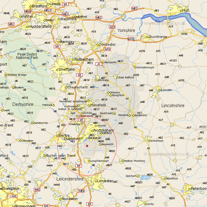
Nottinghamshire Map Showing Location of Barton
Population: 273
District: Rushcliffe
Easting: 452725 Northing: 330236
Latitude: 52.87 Longitude: -1.22
 = Barton
District: Rushcliffe
Easting: 452725 Northing: 330236
Latitude: 52.87 Longitude: -1.22
= Barton
This Barton map below is supplied by Google. Use the tools in the top left corner to zoom into street level or zoom out for a road map, you may also need to zoom in to see Barton on the map. Click and drag the map to move around. If the map fails to load try and refresh your browser or zoom in or out (+ or -).
Update - it seems Google no longer allow people to use their maps for free! This Barton map sometimes loads and sometimes gives a error. I am working on a solution.
Closest 30 Towns or Cities to Barton (Population over 500)
Gotham 2.17km Sutton Bonington 4.34km Ruddington 4.84km Beeston 5.56km Bunny 5.9km Stapleford 6.49km East Leake 6.49km Costock 7.89km Trowell 8.65km West Bridgford 8.71km West Bridgeford 8.71km Tollerton 10.53km Nottingham 11.61km Nottigham 11.61km Cossall 11.98km Cotgrave 12.85km Colwick 12.87km Carlton 12.87km Kimberley 13.39km Awsworth 13.71km Radcliffe-on-Trent 14.36km Radcliffe 14.36km Radcliffe on Trent 14.36km Kinoulton 15.78km Eastwood 15.84km Arnold 15.84km Cropwell Bishop 16.09km Lambley 16.41km Cropwell 16.61km Cropwell Butler 16.61km