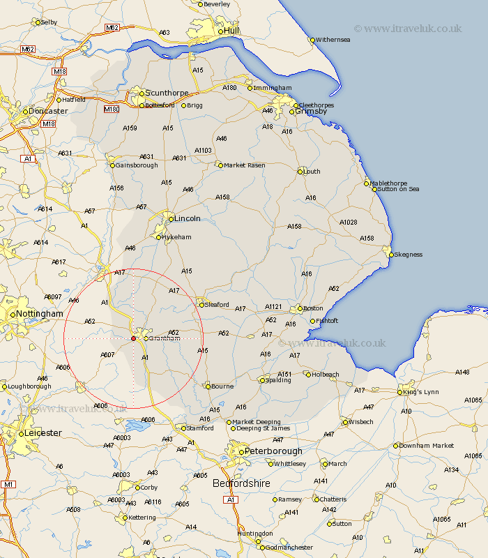
Lincolnshire Map Showing Location of Barrowby
Population: 2020
Area Size (ha): 59
District: South Kesteven
Easting: 488555 Northing: 334464
Latitude: 52.9 Longitude: -0.68
 = Barrowby
Area Size (ha): 59
District: South Kesteven
Easting: 488555 Northing: 334464
Latitude: 52.9 Longitude: -0.68
= Barrowby
This Barrowby map below is supplied by Google. Use the tools in the top left corner to zoom into street level or zoom out for a road map, you may also need to zoom in to see Barrowby on the map. Click and drag the map to move around. If the map fails to load try and refresh your browser or zoom in or out (+ or -).
Update - it seems Google no longer allow people to use their maps for free! This Barrowby map sometimes loads and sometimes gives a error. I am working on a solution.
Closest 30 Towns or Cities to Barrowby (Population over 500)
Great Gonerby 2.17km Grantham 3.35km Harlaxton 3.7km Allington 4.32km Belton 6.7km Long Bennington 8.66km Ropsley 11.33km Colsterworth 11.99km Ancaster 12.49km Caythorpe 14.13km Claypole 15.2km Corby 15.78km Fulbeck 16.27km South Witham 17.27km Folkingham 19.37km Welbourn 20.57km Cranwell 20.74km Sleaford 21.05km Castle Bytham 21.1km Heasingham 22.08km Leasingham 22.08km Rippingale 23.19km Billingborough 23.55km Brauncewell 23.63km Pointon 24.14km Bassingham 24.33km Wellingore 24.4km Navenby 24.88km Morton 24.91km Buskington 24.97km