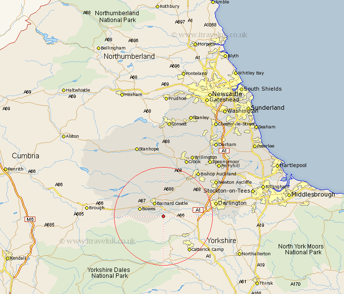
Durham Map Showing Location of Barningham
Population: 185
District: Teesdale
Easting: 408637 Northing: 509795
Latitude: 54.48 Longitude: -1.87
 = Barningham
District: Teesdale
Easting: 408637 Northing: 509795
Latitude: 54.48 Longitude: -1.87
= Barningham
This Barningham map below is supplied by Google. Use the tools in the top left corner to zoom into street level or zoom out for a road map, you may also need to zoom in to see Barningham on the map. Click and drag the map to move around. If the map fails to load try and refresh your browser or zoom in or out (+ or -).
Update - it seems Google no longer allow people to use their maps for free! This Barningham map sometimes loads and sometimes gives a error. I am working on a solution.
Closest 30 Towns or Cities to Barningham (Population over 500)
Barnard Castle 6.43km Startforth 6.43km Staindrop 10.22km Gainford 11.36km Cotherstone 11.95km Cockfield 15.44km Evenwood 16.17km West Auckland 18.77km High Etherley 20km Etherley 20km Darlington 20.15km Middleton in Teesdale 20.38km Shildon 21.76km Bishop Auckland 22.58km Hurworth 22.61km Newton Aycliffe 24.38km Coundon 24.72km Crook 25.58km Wolsingham 25.98km Tow Law 27.98km Willington 28.09km Spennymoor 29.53km Ferryhill 30.19km Stillington 30.82km Stanhope 31.19km Carlton 32.1km Cornforth 33km West Cornforth 33km Bishop Middleham 33.24km Yarm on Tees 33.42km