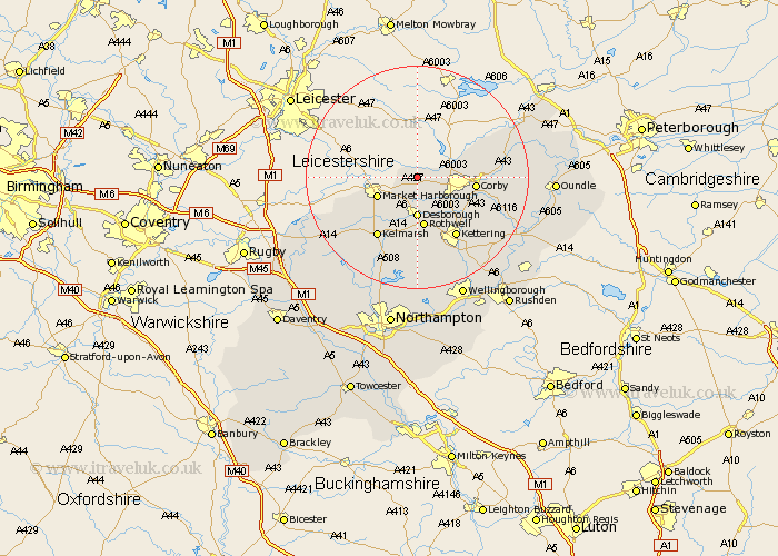
Northamptonshire Map Showing Location of Ashley
Population: 217
District: Kettering
Easting: 480319 Northing: 289820
Latitude: 52.5 Longitude: -0.82
 = Ashley
District: Kettering
Easting: 480319 Northing: 289820
Latitude: 52.5 Longitude: -0.82
= Ashley
This Ashley map below is supplied by Google. Use the tools in the top left corner to zoom into street level or zoom out for a road map, you may also need to zoom in to see Ashley on the map. Click and drag the map to move around. If the map fails to load try and refresh your browser or zoom in or out (+ or -).
Update - it seems Google no longer allow people to use their maps for free! This Ashley map sometimes loads and sometimes gives a error. I am working on a solution.
Closest 30 Towns or Cities to Ashley (Population over 500)
Wilbarston 2.17km Cottingham 4.88km Caldecott 7.02km Desborough 7.42km Rothwell 9.33km Rowell 9.33km Corby 10.32km Gretton 10.8km Geddington 11.69km Stanion 11.88km Weldon 12.55km Clipston 12.94km Kettering 13.02km Broughton 15.2km Brigstock 15.69km Naseby 17.2km Welford 18.32km Isham 18.46km Walgrave 18.53km Burton Latimer 19.53km Brixworth 21.15km Thrapston 22.19km Spratton 22.3km Finedon 22.32km Guilsborough 22.32km Woodford 22.52km Kings Cliffe 22.67km King's Cliffe 22.67km Pitsford 22.69km Islip 23.18km