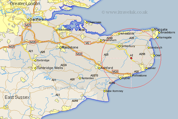
Kent Map Showing Location of Womenswold
Population: 300
District: Canterbury
Easting: 622365 Northing: 149405
Latitude: 51.2 Longitude: 1.18
 = Womenswold
District: Canterbury
Easting: 622365 Northing: 149405
Latitude: 51.2 Longitude: 1.18
= Womenswold
This Womenswold map below is supplied by Google. Use the tools in the top left corner to zoom into street level or zoom out for a road map, you may also need to zoom in to see Womenswold on the map. Click and drag the map to move around. If the map fails to load try and refresh your browser or zoom in or out (+ or -).
Update - it seems Google no longer allow people to use their maps for free! This Womenswold map sometimes loads and sometimes gives a error. I am working on a solution.
Closest 30 Towns or Cities to Womenswold (Population over 500)
Shepherdswell 3.95km Sibertswold 3.95km Bridge 5.94km Coldred 5.94km Eythorne 7.21km Staple 7.24km Elham 7.25km Lydden 7.25km Swingfield 7.42km Littlebourne 7.51km Wingham 7.77km Temple Ewell 8.04km Ewell 8.04km Alkham 8.2km Stelling 8.34km Lower Hardres 8.93km Eastry 8.93km River 9.42km Petham 9.47km Langdon 10km West Langdon 10km Sturry 10.36km Northbourne 10.61km St. Margarets 10.83km St Margaret at Cliffe 10.83km St Margaret's at Cliffe 10.83km St. Margaret's at Cliffe 10.83km Saint Margarets 10.83km Saint Margaret's at Cliffe 10.83km St. Margaret at Cliffe 10.83km