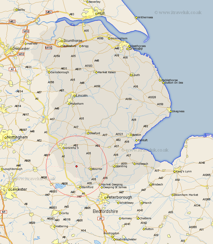
Lincolnshire Map Showing Location of Swayfield
Population: 338
District: South Kesteven
Easting: 500032 Northing: 321704
Latitude: 52.78 Longitude: -0.52
 = Swayfield
District: South Kesteven
Easting: 500032 Northing: 321704
Latitude: 52.78 Longitude: -0.52
= Swayfield
This Swayfield map below is supplied by Google. Use the tools in the top left corner to zoom into street level or zoom out for a road map, you may also need to zoom in to see Swayfield on the map. Click and drag the map to move around. If the map fails to load try and refresh your browser or zoom in or out (+ or -).
Update - it seems Google no longer allow people to use their maps for free! This Swayfield map sometimes loads and sometimes gives a error. I am working on a solution.
Closest 30 Towns or Cities to Swayfield (Population over 500)
Corby 1.86km Castle Bytham 5.67km Colsterworth 6.98km South Witham 7.68km Bourne 9.16km Bourn 9.16km Morton 10.09km Rippingale 10.75km Ropsley 11.12km Folkingham 12.14km Thurlby 12.52km Pointon 14.38km Harlaxton 14.54km Baston 14.55km Stamford 14.99km Grantham 15.16km Langfoft 15.43km Langtoft 15.43km Uffington 16.28km Billingborough 16.59km Barrowby 17.14km Belton 17.59km Great Gonerby 17.93km Market Deeping 19.52km Ancaster 20.42km Allington 21.41km Deeping Saint James 21.6km Deeping St. James 21.6km Deeping St James 21.6km Helpringham 22.13km