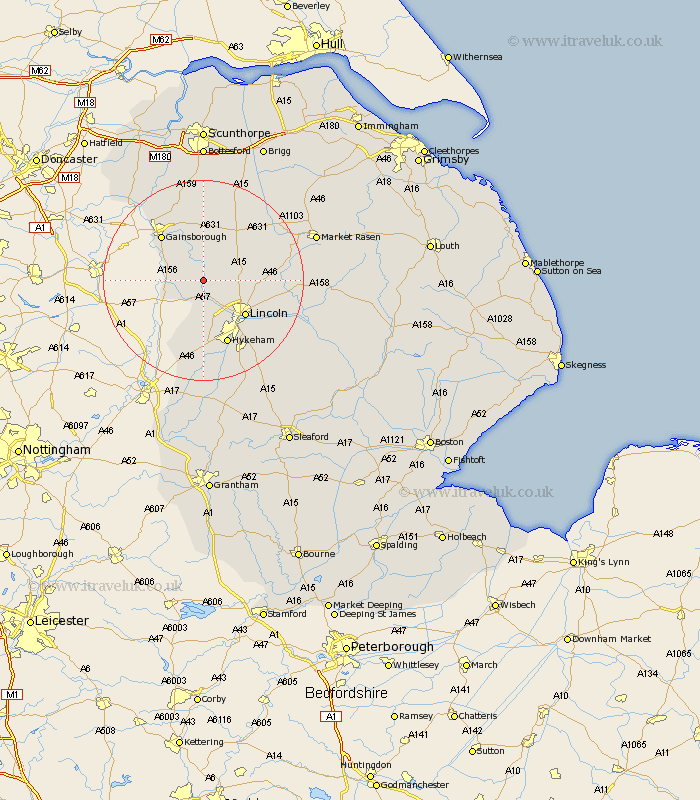
Lincolnshire Map Showing Location of Sturton
District: West Lindsey
Easting: 489958 Northing: 378996
Latitude: 53.3 Longitude: -0.65
 = Sturton
Easting: 489958 Northing: 378996
Latitude: 53.3 Longitude: -0.65
= Sturton
This Sturton map below is supplied by Google. Use the tools in the top left corner to zoom into street level or zoom out for a road map, you may also need to zoom in to see Sturton on the map. Click and drag the map to move around. If the map fails to load try and refresh your browser or zoom in or out (+ or -).
Update - it seems Google no longer allow people to use their maps for free! This Sturton map sometimes loads and sometimes gives a error. I am working on a solution.
Closest 30 Towns or Cities to Sturton (Population over 500)
Saxilby 3.7km Scrampton 5.54km Scampton 5.54km Ingham 5.77km Marton 5.84km Torksey 5.84km Willingham 5.98km Skellingthorpe 7.74km Lea 9.95km Lincoln 10.73km Welton 11.08km Nettleham 11.68km Gainesborough 12.07km Gainsborough 12.07km Dunholme 12.18km Dunholm 12.18km North Scarle 12.43km Thorpe-on-the-Hill 13.02km Thorpe 13.02km Thorpe on the Hill 13.02km Eagle 13.16km Scothern 13.42km North Hykeham 13.71km Hykeham 13.71km Sudbrooke 13.8km Morton 14.21km Washingborough 15.31km Blyton 15.47km Fiskerton 16.21km Reepham 16.21km