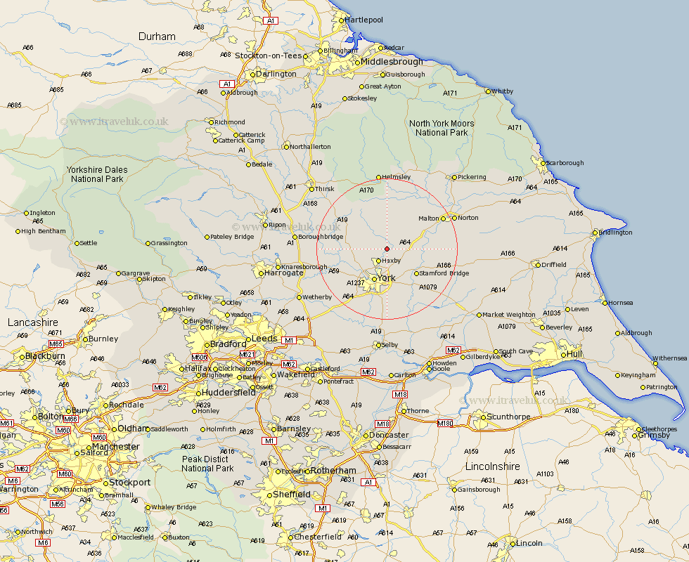
Yorkshire Map Showing Location of Strensall
Population: 4250
Area Size (ha): 131
Easting: 463281 Northing: 462012
Latitude: 54.05 Longitude: -1.03
 = Strensall
Area Size (ha): 131
Easting: 463281 Northing: 462012
Latitude: 54.05 Longitude: -1.03
= Strensall
This Strensall map below is supplied by Google. Use the tools in the top left corner to zoom into street level or zoom out for a road map, you may also need to zoom in to see Strensall on the map. Click and drag the map to move around. If the map fails to load try and refresh your browser or zoom in or out (+ or -).
Update - it seems Google no longer allow people to use their maps for free! This Strensall map sometimes loads and sometimes gives a error. I am working on a solution.
Closest 30 Towns or Cities to Strensall (Population over 500)
Sheriff Hutton 4.29km Haxby 4.3km Wigginton 4.3km Huntington 5.67km Earswick 5.67km Huby 7.5km New Earswick 7.73km Stillington 7.78km Shipton 7.84km Skelton 8.58km Terrington 8.6km York 9.82km Clifton 10.24km Stamford Bridge 10.63km Heslington 11.12km Poppleton 12km Upper Poppleton 12km Tollerton 12.11km Newton upon Ouse 12.11km Newton 12.11km Easingwold 13.16km Slingsby 13.47km Alne 13.57km Bishopthorne 13.69km Bishopthorpe 13.69km Linton on Ouse 14.27km Linton upon Ouse 14.27km Linton-on-Ouse 14.27km Linton 14.27km Wilberfoss 14.82km