Essex Map Showing Location of Stifford
Easting: 560839 Northing: 178637
Latitude: 51.48 Longitude: 0.32
 = Stifford
Latitude: 51.48 Longitude: 0.32
= Stifford
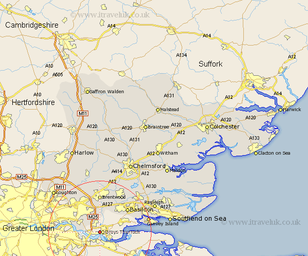
This Stifford map below is supplied by Google. Use the tools in the top left corner to zoom into street level or zoom out for a road map, you may also need to zoom in to see Stifford on the map. Click and drag the map to move around. If the map fails to load try and refresh your browser or zoom in or out (+ or -).
Update - it seems Google no longer allow people to use their maps for free! This Stifford map sometimes loads and sometimes gives a error. I am working on a solution.
Closest 30 Towns or Cities to Stifford (Population over 500)
Grays 1.15km Grays Thurrock 1.15km South Ockedon 2.19km South Ockendon 2.19km Aveley 4.62km Tilbury 5.07km Tilbury Fort 5.07km Stanford le Hope 7.17km Corringham 10.12km Ingrave 11.18km Herongate 11.42km Great Burstead 13.09km Basildon 13.92km Brentwood 14.83km Billericay 16.37km Mountnessing 16.84km Benfleet 17.08km South Benfleet 17.08km Ramsden Heath 17.46km Navestock 17.65km Wickford 18.97km Canvey Island 19.27km Stock 20.21km Kelvedon Hatch 20.52km Ingatestone 20.91km Stanford Rivers 21.53km Rawreth 21.62km South Hanningfield 21.66km Chigwell 21.92km West Hanningfield 22.45km