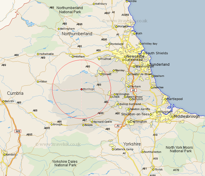
Durham Map Showing Location of Stanhope
Population: 1328
Area Size (ha): 50
District: Wear Valley
Easting: 398927 Northing: 539461
Latitude: 54.75 Longitude: -2.02
 = Stanhope
Area Size (ha): 50
District: Wear Valley
Easting: 398927 Northing: 539461
Latitude: 54.75 Longitude: -2.02
= Stanhope
This Stanhope map below is supplied by Google. Use the tools in the top left corner to zoom into street level or zoom out for a road map, you may also need to zoom in to see Stanhope on the map. Click and drag the map to move around. If the map fails to load try and refresh your browser or zoom in or out (+ or -).
Update - it seems Google no longer allow people to use their maps for free! This Stanhope map sometimes loads and sometimes gives a error. I am working on a solution.
Closest 30 Towns or Cities to Stanhope (Population over 500)
Wolsingham 9.33km Tow Law 12.97km Castleside 13.35km Middleton in Teesdale 15.43km Consetti 16.18km Consett 16.18km Cornsay 16.46km Leadgate 19km Crook 19.02km Lanchester 19.62km Cockfield 20.34km Etherley 20.43km High Etherley 20.43km Cotherstone 20.49km Esh 20.65km Willington 20.66km Annfield Plain 21.29km Evenwood 21.86km West Auckland 22.36km Langley Park 23.13km Ushaw Moor 23.81km Stanley 24.02km Staindrop 24.69km Barnard Castle 24.94km Startforth 24.94km Bishop Auckland 25.09km Witton Gilbert 25.21km Coundon 25.31km Burnopfield 25.45km Brandon 25.67km