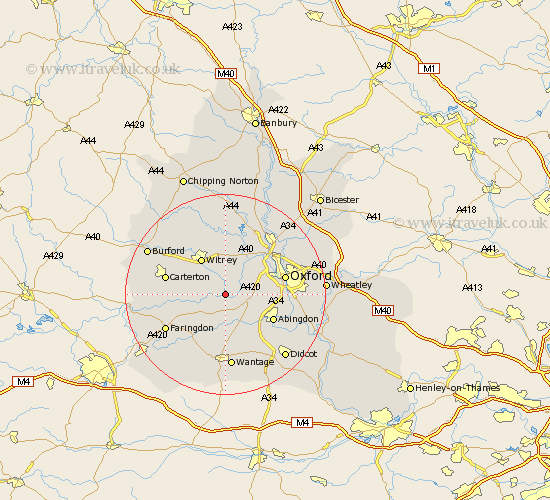
Oxfordshire Map Showing Location of Standlake
Population: 1295
District: West Oxfordshire
Easting: 440294 Northing: 202208
Latitude: 51.72 Longitude: -1.42
 = Standlake
District: West Oxfordshire
Easting: 440294 Northing: 202208
Latitude: 51.72 Longitude: -1.42
= Standlake
This Standlake map below is supplied by Google. Use the tools in the top left corner to zoom into street level or zoom out for a road map, you may also need to zoom in to see Standlake on the map. Click and drag the map to move around. If the map fails to load try and refresh your browser or zoom in or out (+ or -).
Update - it seems Google no longer allow people to use their maps for free! This Standlake map sometimes loads and sometimes gives a error. I am working on a solution.
Closest 30 Towns or Cities to Standlake (Population over 500)
Stanton Harcourt 2.17km Longworth 3.89km Kingston Bagpuze 5.56km Kingston Bagpuize 5.56km Cumnor 5.74km Ducklington 5.9km Ensham 6.02km Eynsham 6.02km Buckland 7.99km Bampton 8.04km Wootton 8.25km Witney 8.71km Cassington 8.71km North Leigh 9.33km North Hinksey 9.37km Marcham 9.38km Hanborough 9.54km Church Handborough 9.54km Sunningwell 9.91km Hailey 10.34km Abingdon-on-Thames 10.74km Abingdon 10.74km Abingdon on Thames 10.74km Stanford in the Vale 10.91km East Hanney 11.18km Hanney 11.18km Clanfield 11.63km Brize Norton 11.73km Bladon 12.03km Oxford 12.06km