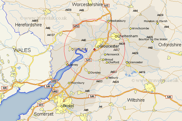
Gloucestershire Map Showing Location of Quedgeley
Population: 11800
District: Gloucester
Easting: 380471 Northing: 213206
Latitude: 51.82 Longitude: -2.28
 = Quedgeley
District: Gloucester
Easting: 380471 Northing: 213206
Latitude: 51.82 Longitude: -2.28
= Quedgeley
This Quedgeley map below is supplied by Google. Use the tools in the top left corner to zoom into street level or zoom out for a road map, you may also need to zoom in to see Quedgeley on the map. Click and drag the map to move around. If the map fails to load try and refresh your browser or zoom in or out (+ or -).
Update - it seems Google no longer allow people to use their maps for free! This Quedgeley map sometimes loads and sometimes gives a error. I am working on a solution.
Closest 30 Towns or Cities to Quedgeley (Population over 500)
Quedgeley 0km Hardwicke 1.15km Gloucester 2.94km Randwick 6.01km Stonehouse 7.42km Hucclecote 7.81km Painswick 7.82km Frampton 7.99km Frampton-on-Severn 7.99km Frampton on Severn 7.99km Brockworth 8.83km Innsworth 9.36km Stroud 9.37km Huntley 9.75km Tibberton 10.33km Newnham 10.48km Newham 10.48km Churchdown 10.91km Hartpury 11.18km Coaley 11.64km Woodchester 11.64km Awre 11.72km Chalford 12.27km Shurdington 12.73km Longhope 12.73km Corse 13.02km Ashleworth 13.02km Slimbridge 13.08km Staverton 13.7km Cinderford 13.75km