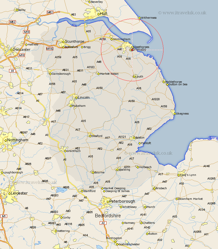
Lincolnshire Map Showing Location of Humberston
Population: 6857
Area Size (ha): 237
Easting: 530331 Northing: 405898
Latitude: 53.53 Longitude: -0.03
 = Humberston
Area Size (ha): 237
Easting: 530331 Northing: 405898
Latitude: 53.53 Longitude: -0.03
= Humberston
This Humberston map below is supplied by Google. Use the tools in the top left corner to zoom into street level or zoom out for a road map, you may also need to zoom in to see Humberston on the map. Click and drag the map to move around. If the map fails to load try and refresh your browser or zoom in or out (+ or -).
Update - it seems Google no longer allow people to use their maps for free! This Humberston map sometimes loads and sometimes gives a error. I am working on a solution.
Closest 30 Towns or Cities to Humberston (Population over 500)
Great Grimsby 1.1km Grimsby 1.1km Cleethorpes 1.86km Holton le Clay 2.87km Waltham 4.78km Great Coates 4.97km Tetney 5.67km North Thoresby 7.49km North Coates 8.62km Laceby 8.81km Fulstow 9.33km Healing 9.56km Grainthorpe 10.7km Stallingborough 11.36km South Killingholme 13.72km Immingham 14.2km Keelby 14.79km binbrook 14.91km Habrough 16.12km North Somercotes 16.46km Louth 18.56km Saltfleet 19.33km Caistor 19.54km Nettleton 19.54km Grimoldby 20.07km Manby 20.52km Saltfleetby St. Clement 20.63km Saltfleetby Saint Clement 20.63km Saltfleetby St Clement 20.63km Saltfleetby 20.63km