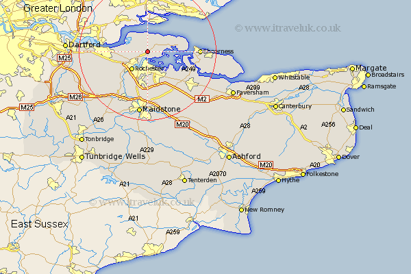
Kent Map Showing Location of High Halstow
Population: 1781
Easting: 577230 Northing: 173616
Latitude: 51.43 Longitude: 0.55
 = High Halstow
Easting: 577230 Northing: 173616
Latitude: 51.43 Longitude: 0.55
= High Halstow
This High Halstow map below is supplied by Google. Use the tools in the top left corner to zoom into street level or zoom out for a road map, you may also need to zoom in to see High Halstow on the map. Click and drag the map to move around. If the map fails to load try and refresh your browser or zoom in or out (+ or -).
Update - it seems Google no longer allow people to use their maps for free! This High Halstow map sometimes loads and sometimes gives a error. I am working on a solution.
Closest 30 Towns or Cities to High Halstow (Population over 500)
Hoo 3.88km Stoke 4.62km Gillingham 5.76km Higham 5.78km Chatham 6.02km Strood 6.55km Rochester 7.09km Allhallows 7.86km Shorne 8.9km Upchurch 10.15km Lower Halstow 10.97km Cuxton 11.57km Grain 11.7km Cobham 11.8km Newington 12.3km Wouldham 12.53km Gravesend 12.71km Burham 13.77km Bobbing 13.93km Stockbury 14.71km Iwade 14.72km Meopham 14.72km Northfleet 15.02km Sheerness 15.02km Queenborough 15.14km Snodland 15.29km Swanscombe 16.17km Southfleet 16.6km Borden 16.63km Boxley 16.68km