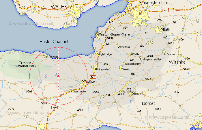
Somerset Map Showing Location of Clatworthy
Population: 89
District: West Somerset
Easting: 305417 Northing: 130633
Latitude: 51.07 Longitude: -3.35
 = Clatworthy
District: West Somerset
Easting: 305417 Northing: 130633
Latitude: 51.07 Longitude: -3.35
= Clatworthy
This Clatworthy map below is supplied by Google. Use the tools in the top left corner to zoom into street level or zoom out for a road map, you may also need to zoom in to see Clatworthy on the map. Click and drag the map to move around. If the map fails to load try and refresh your browser or zoom in or out (+ or -).
Update - it seems Google no longer allow people to use their maps for free! This Clatworthy map sometimes loads and sometimes gives a error. I am working on a solution.
Closest 30 Towns or Cities to Clatworthy (Population over 500)
Wiveliscombe 4.38km Williton 7.5km Stogumber 8.19km Milverton 8.93km Watchet 11.18km Bishops Lydeard 11.65km Oake 11.87km Carhampton 13.77km Brushford 13.97km Dulverton 14.46km Norton Fitzwarren 14.47km Wellington 14.52km Nether Stowey 15.8km West Buckland 16.11km Kingston 16.3km Taunton 16.73km Spaxton 17.22km Minehead 17.5km Trull 17.92km Pitminster 19.75km Stokscourey 19.92km Stoke Courcy 19.92km Stogursey 19.92km West Monkton 21.05km Durleigh 21.68km Dunster 22.02km Otterhampton 22.68km North Petherton 23.58km Creech Saint Michael 23.96km Creech St. Michael 23.96km