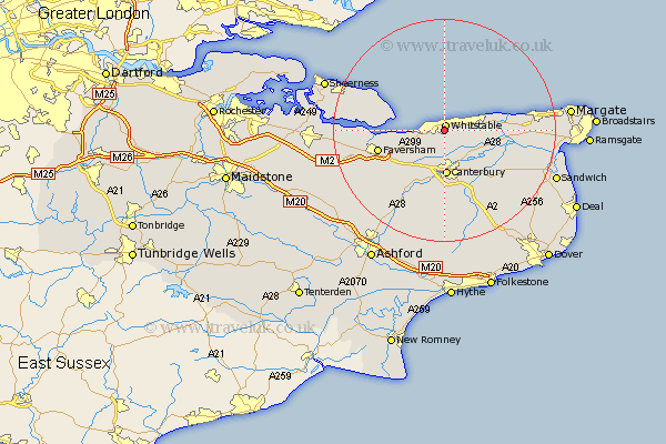
Kent Map Showing Location of Chestfield
Population: 2915
District: Canterbury
Easting: 613521 Northing: 165733
Latitude: 51.35 Longitude: 1.07
 = Chestfield
District: Canterbury
Easting: 613521 Northing: 165733
Latitude: 51.35 Longitude: 1.07
= Chestfield
This Chestfield map below is supplied by Google. Use the tools in the top left corner to zoom into street level or zoom out for a road map, you may also need to zoom in to see Chestfield on the map. Click and drag the map to move around. If the map fails to load try and refresh your browser or zoom in or out (+ or -).
Update - it seems Google no longer allow people to use their maps for free! This Chestfield map sometimes loads and sometimes gives a error. I am working on a solution.
Closest 30 Towns or Cities to Chestfield (Population over 500)
Whitstable 0.99km Herne Bay 4.99km Blean 5.68km Broomfield 5.79km Hoath 7.19km Hackington 7.51km Harbledown 7.77km Canterbury 8.16km Sturry 8.19km Dunkirk 9.41km Chislet 9.45km Littlebourne 11.58km Chartham 11.65km Leysdown 11.8km Leysdown-on-Sea 11.8km Leysdown on Sea 11.8km Faversham 12.16km Saint Nicholas at Wade 12.73km St. Nicholas at Wade 12.73km St Nicholas at Wade 12.73km Warden 12.84km Preston 12.85km Lower Hardres 12.98km Oare 13.26km Bridge 13.43km Wingham 13.95km Selling 13.95km Chilham 14.72km Petham 14.87km Eastchurch 14.95km