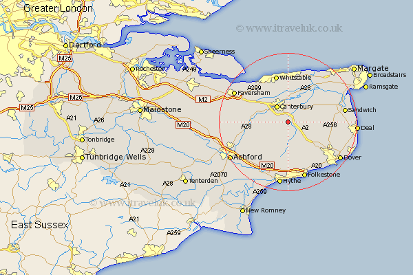
Kent Map Showing Location of Bridge
Population: 1467
District: Canterbury
Easting: 617552 Northing: 152907
Latitude: 51.23 Longitude: 1.12
 = Bridge
District: Canterbury
Easting: 617552 Northing: 152907
Latitude: 51.23 Longitude: 1.12
= Bridge
This Bridge map below is supplied by Google. Use the tools in the top left corner to zoom into street level or zoom out for a road map, you may also need to zoom in to see Bridge on the map. Click and drag the map to move around. If the map fails to load try and refresh your browser or zoom in or out (+ or -).
Update - it seems Google no longer allow people to use their maps for free! This Bridge map sometimes loads and sometimes gives a error. I am working on a solution.
Closest 30 Towns or Cities to Bridge (Population over 500)
Lower Hardres 3.48km Petham 5km Littlebourne 5.09km Sturry 5.56km Canterbury 5.69km Hackington 6.02km Stelling 6.56km Chartham 7.2km Wingham 7.89km Harbledown 8.03km Blean 8.75km Elham 9.26km Staple 9.47km Shepherdswell 9.85km Sibertswold 9.85km Chilham 10.44km Dunkirk 10.82km Preston 11km Hoath 11.65km Coldred 11.88km Swingfield 12.05km Chislet 12.54km Eastry 12.76km Eythorne 12.87km Lydden 13.12km Lyminge 13.17km Broomfield 13.34km Chestfield 13.43km Brabourne 13.77km Alkham 13.78km