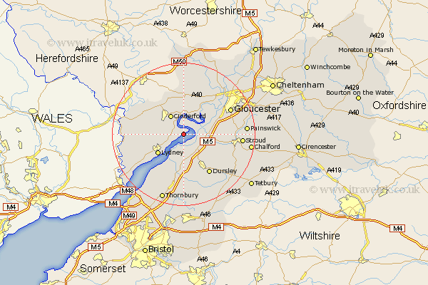
Gloucestershire Map Showing Location of Awre
Population: 1644
District: Forest of Dean
Easting: 370100 Northing: 207697
Latitude: 51.77 Longitude: -2.43
 = Awre
District: Forest of Dean
Easting: 370100 Northing: 207697
Latitude: 51.77 Longitude: -2.43
= Awre
This Awre map below is supplied by Google. Use the tools in the top left corner to zoom into street level or zoom out for a road map, you may also need to zoom in to see Awre on the map. Click and drag the map to move around. If the map fails to load try and refresh your browser or zoom in or out (+ or -).
Update - it seems Google no longer allow people to use their maps for free! This Awre map sometimes loads and sometimes gives a error. I am working on a solution.
Closest 30 Towns or Cities to Awre (Population over 500)
Newham 3.7km Newnham 3.7km Frampton-on-Severn 4.59km Frampton on Severn 4.59km Frampton 4.59km Cinderford 6.53km Slimbridge 6.54km Coaley 8.85km Lydney 8.85km Berkeley 9.35km Bream 9.36km Cam 9.38km Drybrook 10.33km Stonehouse 10.49km Hardwicke 10.72km Longhope 11.18km Huntley 11.35km Mitcheldean 11.64km Milcheldean 11.64km North Nibley 11.64km Quedgeley 11.72km Coleford 12.05km Uley 12.27km Randwick 12.62km Dursley 13.08km Stone 13.18km Woolaston 13.67km Lydbrook 13.86km Gloucester 14.62km Woodchester 14.85km