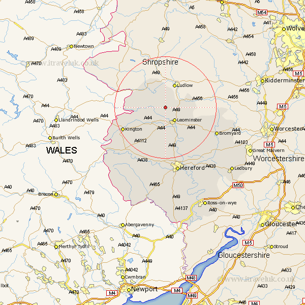
Herefordshire Map Showing Location of Yarpole
Easting: 346569 Northing: 265350
Latitude: 52.28 Longitude: -2.78
 = Yarpole
Latitude: 52.28 Longitude: -2.78
= Yarpole
This Yarpole map below is supplied by Google. Use the tools in the top left corner to zoom into street level or zoom out for a road map, you may also need to zoom in to see Yarpole on the map. Click and drag the map to move around. If the map fails to load try and refresh your browser or zoom in or out (+ or -).
Update - it seems Google no longer allow people to use their maps for free! This Yarpole map sometimes loads and sometimes gives a error. I am working on a solution.
Closest 30 Towns or Cities to Yarpole (Population over 500)
Croft 1.13km Luston 2.92km Orleton 2.93km Kingsland 3.87km Wigmore 5.86km Brimfield 5.96km Leominster 6.52km Shobdon 6.77km Eardisland 8.69km Pembridge 10.86km Leintwardine 10.87km Dilwyn 12.48km Weobley 14.15km Bodenham 16.31km Lyonshall 16.47km Wellington 16.83km Kington 18.39km Almeley 20.13km Burghill 20.41km Credenhill 20.41km Moreton-on-Lugg 20.67km Moreton on Lugg 20.67km Moreton 20.67km Sutton 21.49km Bromyard 22.27km Eardisley 22.28km Withington 22.8km Lugwardine 25.74km Hereford 26.34km Whitbourne 27.13km