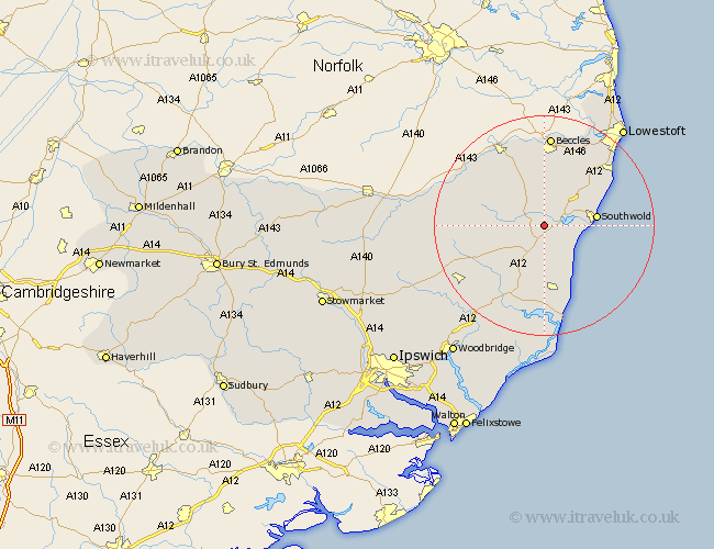
Suffolk Map Showing Location of Wenhaston
Population: 818
District: Suffolk Coastal
Easting: 641923 Northing: 274710
Latitude: 52.32 Longitude: 1.55
 = Wenhaston
District: Suffolk Coastal
Easting: 641923 Northing: 274710
Latitude: 52.32 Longitude: 1.55
= Wenhaston
This Wenhaston map below is supplied by Google. Use the tools in the top left corner to zoom into street level or zoom out for a road map, you may also need to zoom in to see Wenhaston on the map. Click and drag the map to move around. If the map fails to load try and refresh your browser or zoom in or out (+ or -).
Update - it seems Google no longer allow people to use their maps for free! This Wenhaston map sometimes loads and sometimes gives a error. I am working on a solution.
Closest 30 Towns or Cities to Wenhaston (Population over 500)
Wenhaston 0km Holton 2.92km Halesworth 5.03km Wangford 5.85km Yoxford 6km Cookley 6.8km Reydon 8.75km Southwold 9.25km Saxmundham 11.63km Wrentham 11.7km Laxfield 12.6km Leiston 13.03km Worlingham 14.99km Snape 15.22km Kessingland 15.87km Bungay 16.3km Beccles 16.72km Gisleham 17.21km Thorpe 17.29km Thorpeness 17.29km Fressingfield 17.39km Dennington 17.89km Carlton Colville 17.98km Framlingham 18.47km Aldeburgh 18.85km Stradbroke 19.26km Worlingworth 21.15km Tunstall 21.5km Oulton 22.31km Wickham Market 22.35km