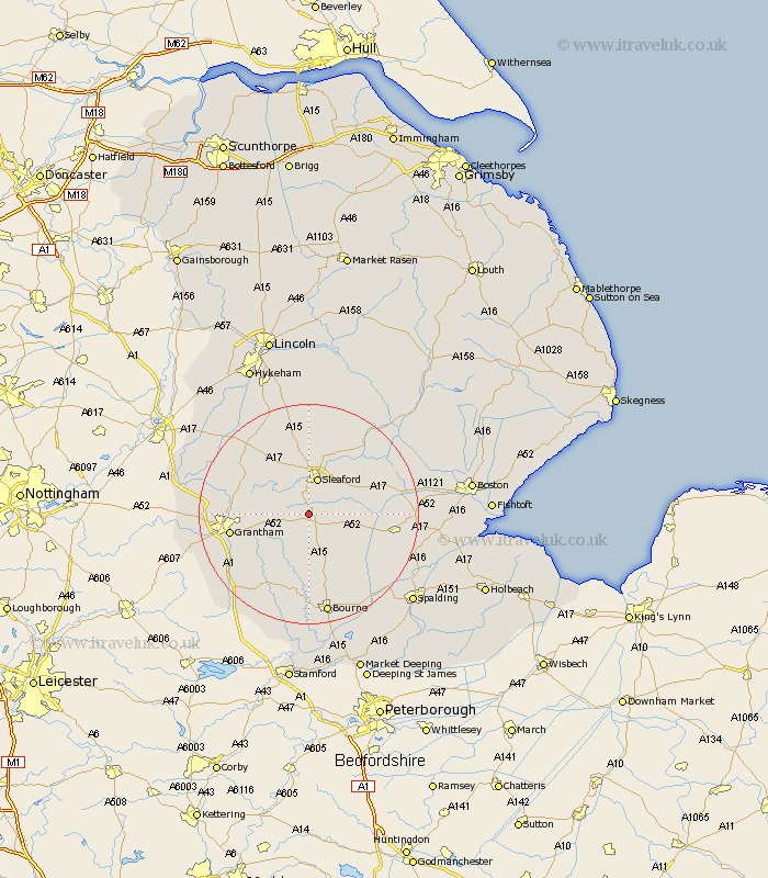
Lincolnshire Map Showing Location of Swarby
District: North Kesteven
Easting: 505287 Northing: 338505
Latitude: 52.93 Longitude: -0.43
 = Swarby
Easting: 505287 Northing: 338505
Latitude: 52.93 Longitude: -0.43
= Swarby
This Swarby map below is supplied by Google. Use the tools in the top left corner to zoom into street level or zoom out for a road map, you may also need to zoom in to see Swarby on the map. Click and drag the map to move around. If the map fails to load try and refresh your browser or zoom in or out (+ or -).
Update - it seems Google no longer allow people to use their maps for free! This Swarby map sometimes loads and sometimes gives a error. I am working on a solution.
Closest 30 Towns or Cities to Swarby (Population over 500)
Sleaford 6.85km Ancaster 7.66km Folkingham 7.73km Ropsley 7.88km Billingborough 8.71km Helpringham 8.94km Leasingham 9.34km Heasingham 9.34km Great Hale 10.22km Hale 10.22km Heckington 10.71km Belton 11.17km Cranwell 11.34km Pointon 11.44km Ruskington 11.61km Buskington 11.61km Brauncewell 12.98km Rippingale 13.72km Grantham 13.91km Caythorpe 14.51km Fulbeck 14.98km Great Gonerby 15.75km Corby 15.84km Donington 16.08km Bloxholm 16.72km Bloxholme 16.72km Welbourn 16.76km Barrowby 17.17km Digby 17.27km Morton 17.27km