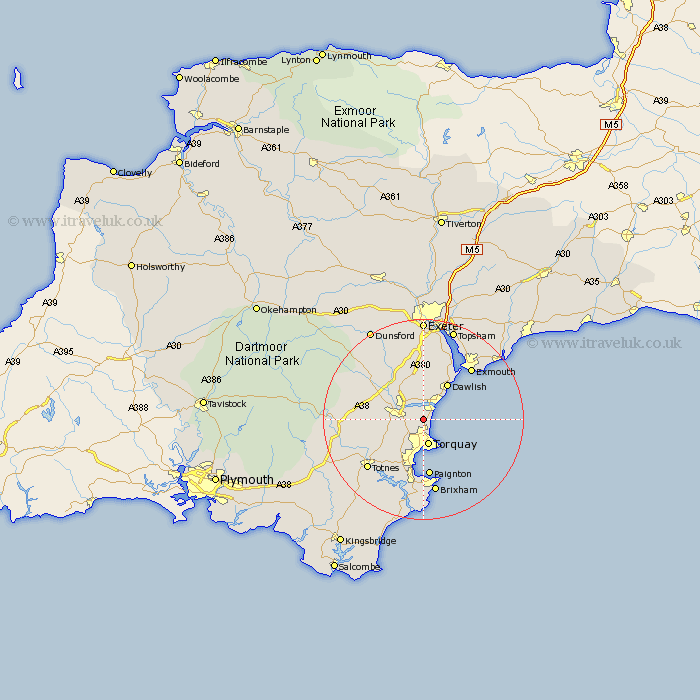
Devon Map Showing Location of Stokeinteignhead
Population: 707
District: Teignbridge
Easting: 291305 Northing: 69734
Latitude: 50.52 Longitude: -3.53
 = Stokeinteignhead
District: Teignbridge
Easting: 291305 Northing: 69734
Latitude: 50.52 Longitude: -3.53
= Stokeinteignhead
This Stokeinteignhead map below is supplied by Google. Use the tools in the top left corner to zoom into street level or zoom out for a road map, you may also need to zoom in to see Stokeinteignhead on the map. Click and drag the map to move around. If the map fails to load try and refresh your browser or zoom in or out (+ or -).
Update - it seems Google no longer allow people to use their maps for free! This Stokeinteignhead map sometimes loads and sometimes gives a error. I am working on a solution.
Closest 30 Towns or Cities to Stokeinteignhead (Population over 500)
Stokeinteignhead 0km Bishopsteignton 3.7km Kingskerswell 3.99km Newton Abbot 5.06km Kingsteignton 5.12km Torquay 5.28km Teignmouth 5.99km Abbotskerswell 6.18km Marldon 7.29km Ipplepen 7.99km Denbury 8.46km Dawlish 8.78km Chudleigh 9.91km Broadhempston 11.24km Paignton 11.55km Berry Pomeroy 12.42km Starcross 12.58km Bovey Tracey 12.93km Staverton 13.03km Hennock 13.21km Kenton 13.79km Stoke Gabriel 14.26km Exmouth 14.29km Brixham 15.02km Totnes 15.06km Ilsington 15.19km Ashburton 15.32km Lympstone 16.96km Christow 16.96km Lustleigh 17.07km