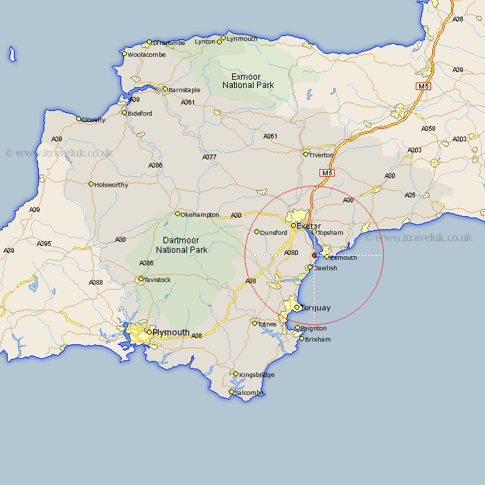
Devon Map Showing Location of Starcross
Population: 1780
District: Teignbridge
Easting: 297430 Northing: 80733
Latitude: 50.62 Longitude: -3.45
 = Starcross
District: Teignbridge
Easting: 297430 Northing: 80733
Latitude: 50.62 Longitude: -3.45
= Starcross
This Starcross map below is supplied by Google. Use the tools in the top left corner to zoom into street level or zoom out for a road map, you may also need to zoom in to see Starcross on the map. Click and drag the map to move around. If the map fails to load try and refresh your browser or zoom in or out (+ or -).
Update - it seems Google no longer allow people to use their maps for free! This Starcross map sometimes loads and sometimes gives a error. I am working on a solution.
Closest 30 Towns or Cities to Starcross (Population over 500)
Kenton 2.19km Exmouth 3.55km Dawlish 3.9km Lympstone 4.39km Topsham 7.41km Teignmouth 7.51km Exminster 7.77km Woodbury Road Station 8.2km Budleigh Salterton 8.43km Bishopsteignton 9.47km Chudleigh 9.59km East Budleigh 10.11km Exeter 10.97km Otterton 11.95km Colyton Raleigh 11.97km Colaton Raleigh 11.97km Kingsteignton 11.98km Ide 12.39km Aylesbeare 12.58km Stokeinteignhead 12.58km Newton Poppleford 14.06km Newton Abbot 14.08km Christow 14.58km Hennock 15.4km Rockbeare 15.55km Sidmouth 15.93km Kingskerswell 16.03km Broad Clyst 16.72km Whitestone 16.73km Bovey Tracey 16.88km