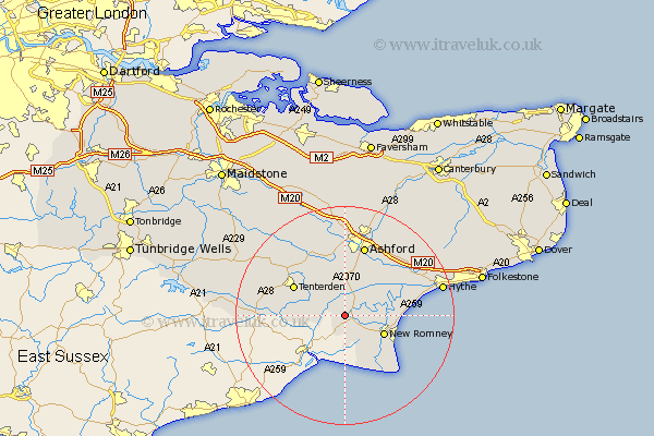
Kent Map Showing Location of Snargate
Population: 112
District: Shepway
Easting: 598706 Northing: 128027
Latitude: 51.02 Longitude: 0.83
 = Snargate
District: Shepway
Easting: 598706 Northing: 128027
Latitude: 51.02 Longitude: 0.83
= Snargate
This Snargate map below is supplied by Google. Use the tools in the top left corner to zoom into street level or zoom out for a road map, you may also need to zoom in to see Snargate on the map. Click and drag the map to move around. If the map fails to load try and refresh your browser or zoom in or out (+ or -).
Update - it seems Google no longer allow people to use their maps for free! This Snargate map sometimes loads and sometimes gives a error. I am working on a solution.
Closest 30 Towns or Cities to Snargate (Population over 500)
Ham Street 3.88km Ruckinge 5.09km Rockinge 5.09km Orlestone 5.68km Woodchurch 7.25km New Romney 7.92km Shadoxhurst 9.33km Kingsnorth 9.34km Lydd 9.44km Wittersham 9.51km Tenterden 10.81km High Halden 11.02km Aldington 11.02km Mersham 11.6km Dymchurch 11.66km Bethersden 12.06km Ashford 13.43km Rolvenden 14.11km Smeeth 14.51km Hinxhill 14.73km Hothfield 14.87km Sellinge 14.88km Sellindge 14.88km Lympne 15.05km Kennington 15.23km Smarden 16.67km Biddenden 16.77km Brabourne 17.43km Beneden 17.87km Benenden 17.87km