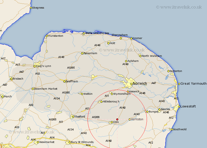
Norfolk Map Showing Location of Shimpling
District: South Norfolk
Easting: 615401 Northing: 282758
Latitude: 52.4 Longitude: 1.17
 = Shimpling
Easting: 615401 Northing: 282758
Latitude: 52.4 Longitude: 1.17
= Shimpling
This Shimpling map below is supplied by Google. Use the tools in the top left corner to zoom into street level or zoom out for a road map, you may also need to zoom in to see Shimpling on the map. Click and drag the map to move around. If the map fails to load try and refresh your browser or zoom in or out (+ or -).
Update - it seems Google no longer allow people to use their maps for free! This Shimpling map sometimes loads and sometimes gives a error. I am working on a solution.
Closest 30 Towns or Cities to Shimpling (Population over 500)
Burston 1.13km Scole 3.7km Diss 3.87km Roydon 5.85km Pulham 5.95km Moulton St Michael 7.5km Great Moulton 7.5km Moulton 7.5km Moulton Saint Michael 7.5km Moulton St. Michael 7.5km Brockdish 7.73km Harleston 7.92km Bressingham 9.24km Bunwell 9.53km Long Stratton 10.31km Banham 10.61km North Lopham 11.31km Forncett St. Mary 11.35km Forncett Saint Mary 11.35km Forncett 11.35km Forncett St Mary 11.35km Old Buckenham 12.18km Kenninghall 12.97km Quidenham 13.62km Hempnall 14.33km Garboldisham 14.82km Ashwellthorpe 14.87km Besthorpe 15.81km East Harling 16.25km Saxlingham 16.3km