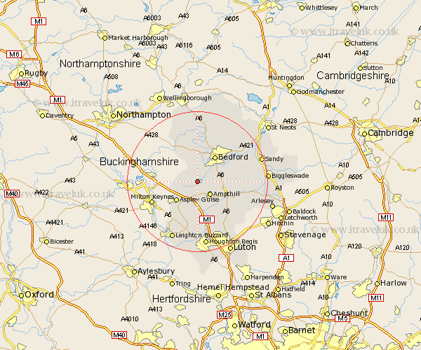
Bedfordshire Map Showing Location of Lower Shelton
Population: 386
District: Bedford
Easting: 499383 Northing: 241963
Latitude: 52.07 Longitude: -0.55
 = Lower Shelton
District: Bedford
Easting: 499383 Northing: 241963
Latitude: 52.07 Longitude: -0.55
= Lower Shelton
This Lower Shelton map below is supplied by Google. Use the tools in the top left corner to zoom into street level or zoom out for a road map, you may also need to zoom in to see Lower Shelton on the map. Click and drag the map to move around. If the map fails to load try and refresh your browser or zoom in or out (+ or -).
Update - it seems Google no longer allow people to use their maps for free! This Lower Shelton map sometimes loads and sometimes gives a error. I am working on a solution.
Closest 30 Towns or Cities to Lower Shelton (Population over 500)
Marston Moretaine 1.86km Wootton 2.93km Cranfield 3.42km Lidlington 3.71km Ampthill 5.05km Kempston 5.87km Houghton Conquest 5.99km Elstow 6.79km Aspley Guise 7.96km Wilshamstead 7.98km Willshamstead 7.98km Wilhamstead 7.98km Wilstead 7.98km Biddenham 8.16km Flitwick 8.71km Maulden 8.81km Bedford 8.82km Haynes 9.3km Bromham 9.54km Flitton 10.09km Clapham 10.32km Woburn 10.33km Clophill 10.68km Stevington 11.12km Oakley 11.35km Pulloxhill 11.52km Silsoe 11.75km Westoning 12.02km Turvey 12.49km Cople 12.67km