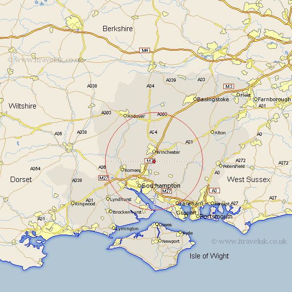
Hampshire Map Showing Location of Shawford
District: Winchester
Easting: 447926 Northing: 124429
Latitude: 51.02 Longitude: -1.32
 = Shawford
Easting: 447926 Northing: 124429
Latitude: 51.02 Longitude: -1.32
= Shawford
This Shawford map below is supplied by Google. Use the tools in the top left corner to zoom into street level or zoom out for a road map, you may also need to zoom in to see Shawford on the map. Click and drag the map to move around. If the map fails to load try and refresh your browser or zoom in or out (+ or -).
Update - it seems Google no longer allow people to use their maps for free! This Shawford map sometimes loads and sometimes gives a error. I am working on a solution.
Closest 30 Towns or Cities to Shawford (Population over 500)
Compton 1.16km Otterbourne 2.98km Owslebury 3.96km Winchester 4.45km Bishopstoke 5.68km Hursley 5.83km Eastleigh 6.03km Sparsholt 7.25km Kings Worthy 7.5km Upham 8.06km Durley 8.76km Chilworth 10.2km Bishop's Waltham 10.2km Bishops Waltham 10.2km Cheriton 11.12km West End 11.18km Botley 11.66km Curbridge 12.06km Curdridge 12.06km Southampton 12.23km New Alresford 12.84km Kings Somborne 12.91km Michlemersh 12.95km Michelmersh 12.95km Romsey 13.36km Micheldever 13.43km Itchen 13.79km Waltham Chase 13.8km Corhampton 13.99km Swanmore 14.01km