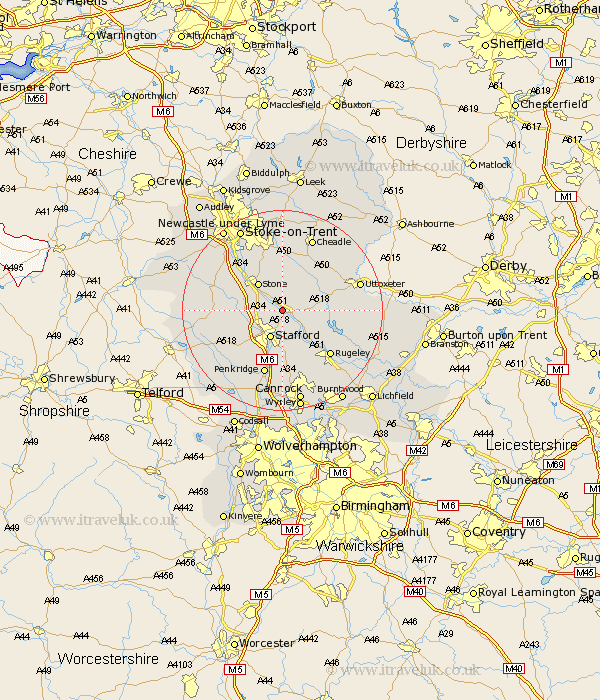
Staffordshire Map Showing Location of Salt
Population: 354
District: Stafford
Easting: 395510 Northing: 328093
Latitude: 52.85 Longitude: -2.07
 = Salt
District: Stafford
Easting: 395510 Northing: 328093
Latitude: 52.85 Longitude: -2.07
= Salt
This Salt map below is supplied by Google. Use the tools in the top left corner to zoom into street level or zoom out for a road map, you may also need to zoom in to see Salt on the map. Click and drag the map to move around. If the map fails to load try and refresh your browser or zoom in or out (+ or -).
Update - it seems Google no longer allow people to use their maps for free! This Salt map sometimes loads and sometimes gives a error. I am working on a solution.
Closest 30 Towns or Cities to Salt (Population over 500)
Hopton 2.91km Weston 3.84km Weston upon Trent 3.84km Stafford 5.99km Stone 7.14km Hilderstone 7.5km Seighford 8.67km Bednall 9.26km Colwich 9.29km Church Leigh 10km Leigh 10km Fulford 11.12km Haughton 11.63km Checkley 12.13km Eccleshall 12.31km Swinnerton 12.5km Swynnerton 12.5km Abbots Bromley 12.86km Rugeley 12.89km Barlaston 12.99km Draycott in the Moors 13.17km Draycott 13.17km Penkridge 13.4km Colton 13.69km Gnosall 14.38km Gnossall 14.38km Caverswall 14.82km Uttoxeter 15.57km Church Eaton 15.78km Cheadle 15.84km