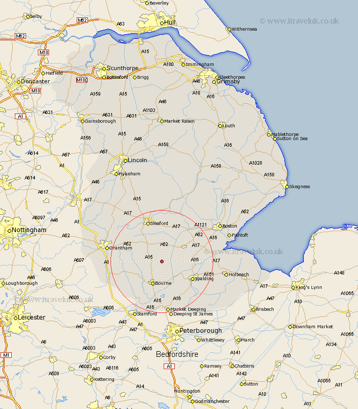
Lincolnshire Map Showing Location of Pointon
Population: 507
District: South Kesteven
Easting: 512222 Northing: 329392
Latitude: 52.85 Longitude: -0.33
 = Pointon
District: South Kesteven
Easting: 512222 Northing: 329392
Latitude: 52.85 Longitude: -0.33
= Pointon
This Pointon map below is supplied by Google. Use the tools in the top left corner to zoom into street level or zoom out for a road map, you may also need to zoom in to see Pointon on the map. Click and drag the map to move around. If the map fails to load try and refresh your browser or zoom in or out (+ or -).
Update - it seems Google no longer allow people to use their maps for free! This Pointon map sometimes loads and sometimes gives a error. I am working on a solution.
Closest 30 Towns or Cities to Pointon (Population over 500)
Pointon 0km Billingborough 3.7km Rippingale 4.33km Folkingham 4.85km Morton 7.74km Helpringham 9.53km Bourne 9.85km Bourn 9.85km Donington 10.54km Quadring 11.34km Hale 11.61km Great Hale 11.61km Gosberton 12.31km Ropsley 12.85km Heckington 13.4km Bicker 13.42km Spalding 13.43km Corby 13.51km Pinchbeck 13.51km Surfleet 13.56km Thurlby 14.99km Swineshead 15.4km Langtoft 16.68km Langfoft 16.68km Baston 16.72km Sleaford 16.74km Deeping Saint Nicholas 17.32km Deeping St. Nicholas 17.32km Deeping St Nicholas 17.32km Sutterton 17.68km