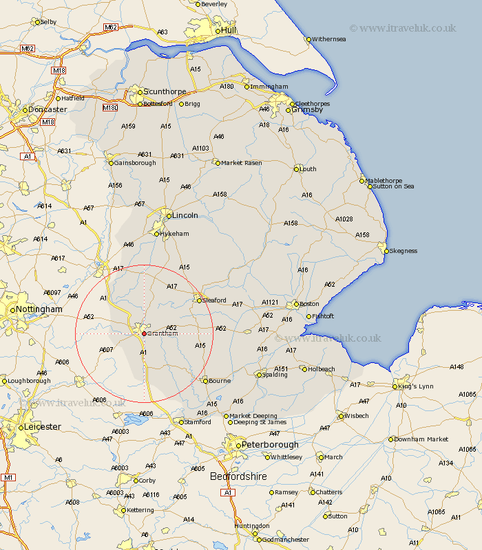
Lincolnshire Map Showing Location of Grantham
Population: 32881
Area Size (ha): 975
District: South Kesteven
Easting: 491918 Northing: 334527
Latitude: 52.9 Longitude: -0.63
 = Grantham
Area Size (ha): 975
District: South Kesteven
Easting: 491918 Northing: 334527
Latitude: 52.9 Longitude: -0.63
= Grantham
This Grantham map below is supplied by Google. Use the tools in the top left corner to zoom into street level or zoom out for a road map, you may also need to zoom in to see Grantham on the map. Click and drag the map to move around. If the map fails to load try and refresh your browser or zoom in or out (+ or -).
Update - it seems Google no longer allow people to use their maps for free! This Grantham map sometimes loads and sometimes gives a error. I am working on a solution.
Closest 30 Towns or Cities to Grantham (Population over 500)
Great Gonerby 2.91km Barrowby 3.35km Belton 4.32km Harlaxton 5km Allington 6.7km Ropsley 8.04km Ancaster 10km Long Bennington 10.78km Colsterworth 11.18km Caythorpe 13.17km Corby 13.6km Fulbeck 15.2km Folkingham 16.09km Claypole 16.27km South Witham 16.72km Sleaford 18.21km Cranwell 18.55km Welbourn 19.36km Heasingham 19.47km Leasingham 19.47km Castle Bytham 19.72km Rippingale 20.16km Billingborough 20.21km Pointon 20.89km Brauncewell 21.39km Morton 22.11km Ruskington 22.36km Buskington 22.36km Bourn 22.4km Bourne 22.4km