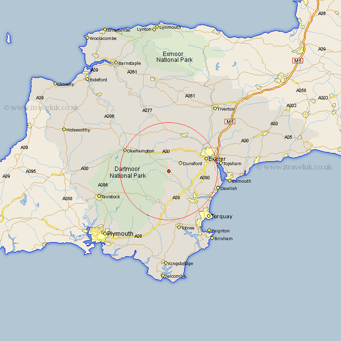
Devon Map Showing Location of Moretonhampstead
Population: 1536
District: Teignbridge
Easting: 276297 Northing: 84894
Latitude: 50.65 Longitude: -3.75
 = Moretonhampstead
District: Teignbridge
Easting: 276297 Northing: 84894
Latitude: 50.65 Longitude: -3.75
= Moretonhampstead
This Moretonhampstead map below is supplied by Google. Use the tools in the top left corner to zoom into street level or zoom out for a road map, you may also need to zoom in to see Moretonhampstead on the map. Click and drag the map to move around. If the map fails to load try and refresh your browser or zoom in or out (+ or -).
Update - it seems Google no longer allow people to use their maps for free! This Moretonhampstead map sometimes loads and sometimes gives a error. I am working on a solution.
Closest 30 Towns or Cities to Moretonhampstead (Population over 500)
Lustleigh 4.39km Dunsford 5.98km Drewsteignton 6.04km Chagford 6.94km Christow 7.05km Hennock 8.09km Bovey Tracey 8.78km Cheriton Bishop 9.34km Ilsington 9.34km Widecombe in the Moor 9.91km Widdecombe 9.91km Tedburn St. Mary 10.38km Tedburn Saint Mary 10.38km Tedburn St Mary 10.38km Holcombe Burnell 11.07km Chudleigh 13.01km Dartmoor Forest 13.9km Whitestone 14.05km South Tawton 14.05km Ide 14.06km Ashburton 14.82km Kingsteignton 16.19km Exeter 16.25km Crediton 16.41km Copplestone 16.68km St Cyres 16.73km St. Cyres 16.73km Saint Cyres 16.73km Newton Saint Cyres 16.73km Newton St Cyres 16.73km