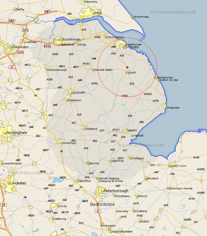
Lincolnshire Map Showing Location of Little Grimsby
Population: 78
District: East Lindsey
Easting: 531848 Northing: 391102
Latitude: 53.4 Longitude: -0.02
 = Little Grimsby
District: East Lindsey
Easting: 531848 Northing: 391102
Latitude: 53.4 Longitude: -0.02
= Little Grimsby
This Little Grimsby map below is supplied by Google. Use the tools in the top left corner to zoom into street level or zoom out for a road map, you may also need to zoom in to see Little Grimsby on the map. Click and drag the map to move around. If the map fails to load try and refresh your browser or zoom in or out (+ or -).
Update - it seems Google no longer allow people to use their maps for free! This Little Grimsby map sometimes loads and sometimes gives a error. I am working on a solution.
Closest 30 Towns or Cities to Little Grimsby (Population over 500)
Louth 3.7km Fulstow 5.56km Grimoldby 7.6km North Thoresby 7.74km North Coates 8.12km Manby 8.58km Legbourne 8.64km Tetney 9.26km Grainthorpe 9.94km binbrook 11.65km North Somercotes 11.65km Saltfleetby Saint Clement 13.26km Saltfleetby St Clement 13.26km Saltfleetby St. Clement 13.26km Saltfleetby 13.26km Saltfleet 13.39km Holton le Clay 13.39km Waltham 14.1km Humberstone 14.86km Humberston 14.86km Great Grimsby 14.99km Grimsby 14.99km Cleethorpes 16.72km Laceby 17.84km Great Coates 19.05km Mablethorpe 19.18km Healing 21.03km Market Rasen 21.08km Alford 21.32km Caistor 21.92km