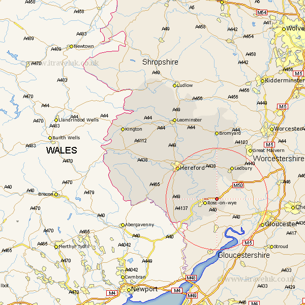
Herefordshire Map Showing Location of Linton
Population: 350
Easting: 365627 Northing: 226253
Latitude: 51.93 Longitude: -2.5
 = Linton
Easting: 365627 Northing: 226253
Latitude: 51.93 Longitude: -2.5
= Linton
This Linton map below is supplied by Google. Use the tools in the top left corner to zoom into street level or zoom out for a road map, you may also need to zoom in to see Linton on the map. Click and drag the map to move around. If the map fails to load try and refresh your browser or zoom in or out (+ or -).
Update - it seems Google no longer allow people to use their maps for free! This Linton map sometimes loads and sometimes gives a error. I am working on a solution.
Closest 30 Towns or Cities to Linton (Population over 500)
Upton Bishop 2.18km Weston-under-Penyard 2.94km Weston under Penyard 2.94km Weston 2.94km Lea 3.7km Ross 4.93km Ross-on-wye 4.93km Ross on Wye 4.93km Much Marcle 7.42km Walford 8.83km Fownhope 10.1km Goodrich 10.91km Whitchurch 13.85km Ledbury 14.18km Much Birch 15.31km Mordiford 15.87km Bosbury 17.03km Much Dewchurch 18.01km Broad Oak 18.03km Lugwardine 18.04km Colwall 18.49km Bullingham 18.54km Hereford 19.71km Cradley 20.54km Withington 20.66km Allensmore 21.51km Sutton 22.38km Moreton-on-Lugg 24.47km Moreton on Lugg 24.47km Moreton 24.47km