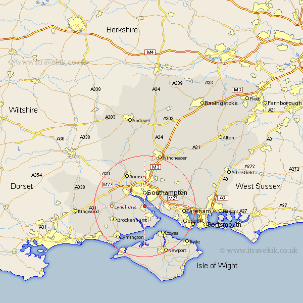
Hampshire Map Showing Location of Hythe
Population: 18106
Area Size (ha): 538
District: New Forest
Easting: 442218 Northing: 107699
Latitude: 50.87 Longitude: -1.4
 = Hythe
Area Size (ha): 538
District: New Forest
Easting: 442218 Northing: 107699
Latitude: 50.87 Longitude: -1.4
= Hythe
This Hythe map below is supplied by Google. Use the tools in the top left corner to zoom into street level or zoom out for a road map, you may also need to zoom in to see Hythe on the map. Click and drag the map to move around. If the map fails to load try and refresh your browser or zoom in or out (+ or -).
Update - it seems Google no longer allow people to use their maps for free! This Hythe map sometimes loads and sometimes gives a error. I am working on a solution.
Closest 30 Towns or Cities to Hythe (Population over 500)
Dibden 2.34km Marchwood 2.98km Itchen 3.88km Netley 4.68km Netley Marsh 4.68km Ashurst 4.78km Southampton 5.93km Hample 6.14km Hamble 6.14km Bewley 6.58km Beaulieu 6.58km Fawley 6.58km Locks Heath 6.8km Eling 6.92km Bursledon 7.02km West End 7.26km Totton 8.07km Chilworth 9.34km Botley 10.88km Eastleigh 11.66km Curbridge 11.9km Curdridge 11.9km Bishopstoke 12.06km Lyndhurst 12.87km Brockenhurst 12.96km Cowes 13.15km Cadnam 14.01km Durley 14.01km Minstead 14.15km Gurnard 14.24km