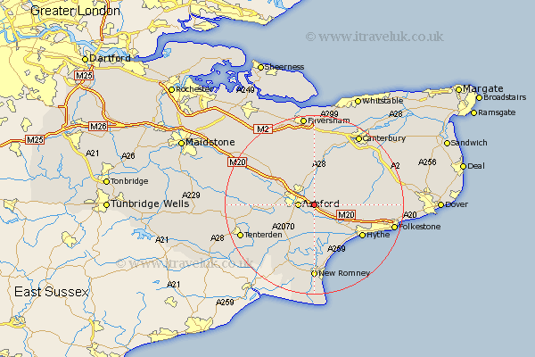
Kent Map Showing Location of Hinxhill
Population: 2384
District: Ashford
Easting: 605201 Northing: 141263
Latitude: 51.13 Longitude: 0.93
 = Hinxhill
District: Ashford
Easting: 605201 Northing: 141263
Latitude: 51.13 Longitude: 0.93
= Hinxhill
This Hinxhill map below is supplied by Google. Use the tools in the top left corner to zoom into street level or zoom out for a road map, you may also need to zoom in to see Hinxhill on the map. Click and drag the map to move around. If the map fails to load try and refresh your browser or zoom in or out (+ or -).
Update - it seems Google no longer allow people to use their maps for free! This Hinxhill map sometimes loads and sometimes gives a error. I am working on a solution.
Closest 30 Towns or Cities to Hinxhill (Population over 500)
Smeeth 2.97km Ashford 3.49km Mersham 3.7km Kennington 3.95km Brabourne 4.65km Wye 5.56km Aldington 5.68km Sellindge 5.95km Sellinge 5.95km Kingsnorth 6.9km Hothfield 8.35km Shadoxhurst 8.95km Orlestone 9.42km Ruckinge 9.9km Rockinge 9.9km Lympne 10.18km Lyminge 10.63km Stelling 10.83km Ham Street 10.94km Chilham 11.36km Bethersden 11.78km Charing 11.89km Petham 12.33km Hythe 12.83km Elham 12.92km Dymchurch 13.78km Woodchurch 13.79km Pluckley 13.94km Chartham 14.22km Lower Hardres 14.49km