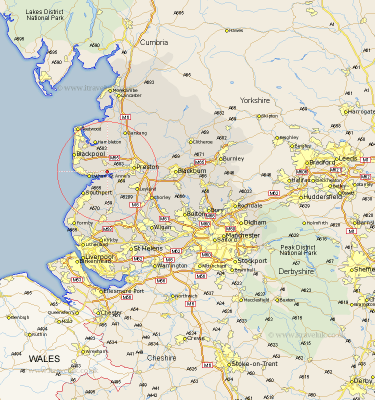
Lancashire Map Showing Location of Freckleton
Population: 8085
Area Size (ha): 425
District: Fylde
Easting: 342856 Northing: 428554
Latitude: 53.75 Longitude: -2.87
 = Freckleton
Area Size (ha): 425
District: Fylde
Easting: 342856 Northing: 428554
Latitude: 53.75 Longitude: -2.87
= Freckleton
This Freckleton map below is supplied by Google. Use the tools in the top left corner to zoom into street level or zoom out for a road map, you may also need to zoom in to see Freckleton on the map. Click and drag the map to move around. If the map fails to load try and refresh your browser or zoom in or out (+ or -).
Update - it seems Google no longer allow people to use their maps for free! This Freckleton map sometimes loads and sometimes gives a error. I am working on a solution.
Closest 30 Towns or Cities to Freckleton (Population over 500)
Freckleton 0km Warton 2.16km Kirkham 3.7km Lea 4.76km Lea Town 4.76km Plumpton 5.74km Longton 5.74km Hutton 6.83km Lytham 6.83km Lytham St Anne's 6.83km Lytham St. Anne's 6.83km Lytham Saint Anne's 6.83km Hoole 7.08km Much Hoole 7.08km Banks 8.11km Penwortham 8.77km Elswick 9.33km Woodplumpton 9.47km Inskip 9.52km Tarleton 9.52km Preston 10.03km Great Singleton 10.24km Singleton 10.24km Bretherton 10.25km Great Eccleston 11.12km Eccleston 11.12km Broughton 11.48km Barton 11.48km Farington 11.57km Farrington 11.57km