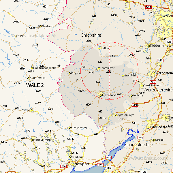
Herefordshire Map Showing Location of Docklow
Population: 118
Easting: 356736 Northing: 257843
Latitude: 52.22 Longitude: -2.63
 = Docklow
Easting: 356736 Northing: 257843
Latitude: 52.22 Longitude: -2.63
= Docklow
This Docklow map below is supplied by Google. Use the tools in the top left corner to zoom into street level or zoom out for a road map, you may also need to zoom in to see Docklow on the map. Click and drag the map to move around. If the map fails to load try and refresh your browser or zoom in or out (+ or -).
Update - it seems Google no longer allow people to use their maps for free! This Docklow map sometimes loads and sometimes gives a error. I am working on a solution.
Closest 30 Towns or Cities to Docklow (Population over 500)
Leominster 7.06km Bodenham 8.16km Luston 9.7km Bromyard 9.82km Brimfield 10.31km Kingsland 11.94km Orleton 12.2km Wellington 12.22km Withington 12.98km Sutton 13.42km Croft 13.55km Moreton-on-Lugg 14.66km Moreton 14.66km Moreton on Lugg 14.66km Eardisland 14.76km Burghill 15.85km Whitbourne 15.9km Shobdon 16.32km Dilwyn 16.33km Lugwardine 16.72km Weobley 16.85km Credenhill 17.25km Pembridge 18.17km Wigmore 18.47km Mordiford 18.54km Hereford 19.39km Bosbury 19.4km Bullingham 21.17km Colwall 22.6km Leintwardine 23.02km