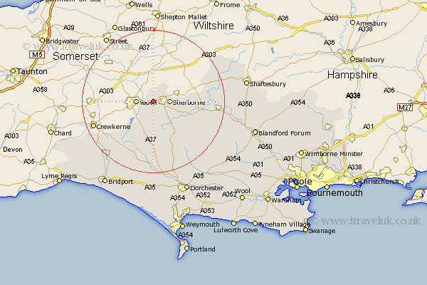
Dorset Map Showing Location of Compton
Population: 63
District: West Dorset
Easting: 360198 Northing: 116943
Latitude: 50.95 Longitude: -2.57
 = Compton
District: West Dorset
Easting: 360198 Northing: 116943
Latitude: 50.95 Longitude: -2.57
= Compton
This Compton map below is supplied by Google. Use the tools in the top left corner to zoom into street level or zoom out for a road map, you may also need to zoom in to see Compton on the map. Click and drag the map to move around. If the map fails to load try and refresh your browser or zoom in or out (+ or -).
Update - it seems Google no longer allow people to use their maps for free! This Compton map sometimes loads and sometimes gives a error. I am working on a solution.
Closest 30 Towns or Cities to Compton (Population over 500)
Bradford Abbas 3.88km Sherbourne 4.67km Sherborne 4.67km Yetminster 5.56km Leigh 9.34km Stalbridge 14.01km Buckland Newton 15.34km Marnhull 17.61km Mosterton 17.9km Cerne Abbas 18.1km Stour Provost 20.18km Sturminster Newton 20.2km Maiden Newton 20.38km East Stour 20.6km Stour 20.6km Bourton 20.85km Beaminster 21.06km Puddletrenthide 21.32km Piddletrenthide 21.32km Broadwindsor 22.08km Broadwinsor 22.08km Netherbury 22.56km Shillingstone 22.88km Gillingham 22.95km Child Okeford 23.65km Charminster 25.45km Motcombe 25.6km Milton Abbas 25.95km Shaftesbury 26.27km Loders 26.3km