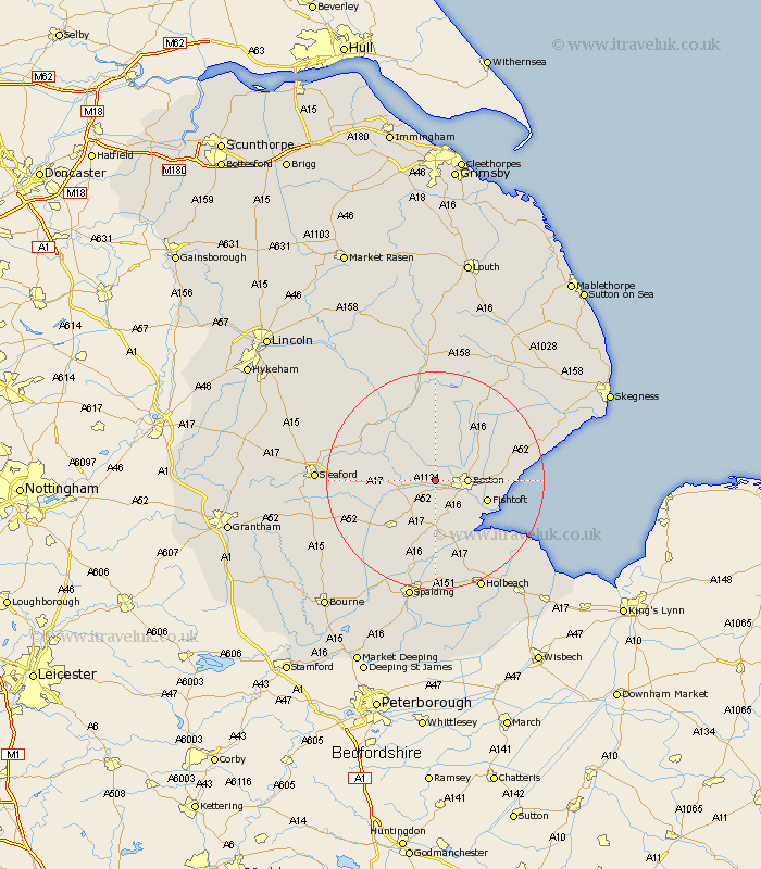
Lincolnshire Map Showing Location of Brothertoft
Population: 652
District: Boston
Easting: 527540 Northing: 344607
Latitude: 52.98 Longitude: -0.1
 = Brothertoft
District: Boston
Easting: 527540 Northing: 344607
Latitude: 52.98 Longitude: -0.1
= Brothertoft
This Brothertoft map below is supplied by Google. Use the tools in the top left corner to zoom into street level or zoom out for a road map, you may also need to zoom in to see Brothertoft on the map. Click and drag the map to move around. If the map fails to load try and refresh your browser or zoom in or out (+ or -).
Update - it seems Google no longer allow people to use their maps for free! This Brothertoft map sometimes loads and sometimes gives a error. I am working on a solution.
Closest 30 Towns or Cities to Brothertoft (Population over 500)
Boston 5.58km Swineshead 6.49km Frithville 7.13km Wyberton 7.88km Kirton 8.13km Bicker 8.65km Frampton 9.27km Sutterton 9.33km Sibsey 9.58km Fishtoft 9.67km Freiston 10.21km Frieston 10.21km Butterwick 11.16km Donington 11.43km Carrington 11.61km Benington 12.27km Bennington 12.27km Leverton 12.41km Heckington 12.41km Great Hale 12.82km Hale 12.82km Stickney 13.58km Quadring 13.71km Leake 13.89km Old Leake 13.89km Helpringham 14.51km Tattershall 14.6km Gosberton 15.2km Coningsby 15.49km Wrangle 15.53km