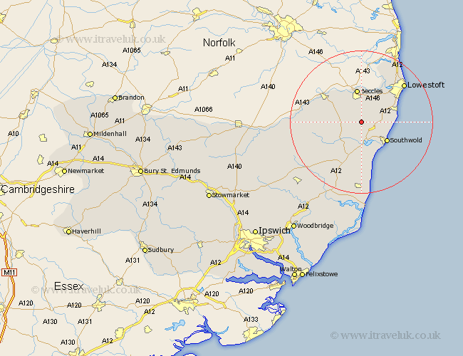
Suffolk Map Showing Location of Brampton
Population: 453
District: Waveney
Easting: 643827 Northing: 282226
Latitude: 52.38 Longitude: 1.58
 = Brampton
District: Waveney
Easting: 643827 Northing: 282226
Latitude: 52.38 Longitude: 1.58
= Brampton
This Brampton map below is supplied by Google. Use the tools in the top left corner to zoom into street level or zoom out for a road map, you may also need to zoom in to see Brampton on the map. Click and drag the map to move around. If the map fails to load try and refresh your browser or zoom in or out (+ or -).
Update - it seems Google no longer allow people to use their maps for free! This Brampton map sometimes loads and sometimes gives a error. I am working on a solution.
Closest 30 Towns or Cities to Brampton (Population over 500)
Wangford 4.34km Halesworth 6.76km Reydon 6.76km Wrentham 6.79km Holton 7.17km Worlingham 7.42km Wenhaston 7.74km Southwold 8.78km Beccles 9.34km Kessingland 9.78km Gisleham 10.62km Carlton Colville 10.84km Bungay 11.69km Cookley 11.7km Yoxford 13.73km Oulton 15.07km Lowestoft 15.85km Laxfield 17.39km Corton 19.35km Saxmundham 19.37km Fressingfield 19.59km Leiston 20.41km Stradbroke 22.75km Snape 22.95km Dennington 23.21km Thorpeness 24.19km Thorpe 24.19km Framlingham 25.14km Aldeburgh 25.97km Worlingworth 26.1km