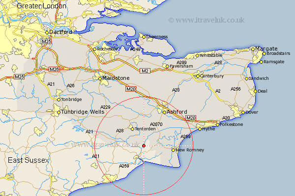
Kent Map Showing Location of Stone
District: Shepway
Easting: 594101 Northing: 125993
Latitude: 51 Longitude: 0.77
 = Stone
Easting: 594101 Northing: 125993
Latitude: 51 Longitude: 0.77
= Stone
This Stone map below is supplied by Google. Use the tools in the top left corner to zoom into street level or zoom out for a road map, you may also need to zoom in to see Stone on the map. Click and drag the map to move around. If the map fails to load try and refresh your browser or zoom in or out (+ or -).
Update - it seems Google no longer allow people to use their maps for free! This Stone map sometimes loads and sometimes gives a error. I am working on a solution.
Closest 30 Towns or Cities to Stone (Population over 500)
Wittersham 4.66km Woodchurch 7.42km Ham Street 8.05km Tenterden 8.69km Orlestone 9.43km Rockinge 9.87km Ruckinge 9.87km High Halden 9.9km Rolvenden 10.03km Shadoxhurst 11.66km New Romney 11.81km Lydd 11.88km Kingsnorth 12.55km Bethersden 12.98km Beneden 13.98km Benenden 13.98km Sandhurst 14.12km Biddenden 14.51km Aldington 15.81km Smarden 15.93km Mersham 16.11km Dymchurch 16.43km Ashford 16.92km Hothfield 17.04km Kennington 18.56km Cranbrook 18.76km Hinxhill 18.85km Hawkhurst 19.02km Smeeth 19.07km Frittenden 19.59km