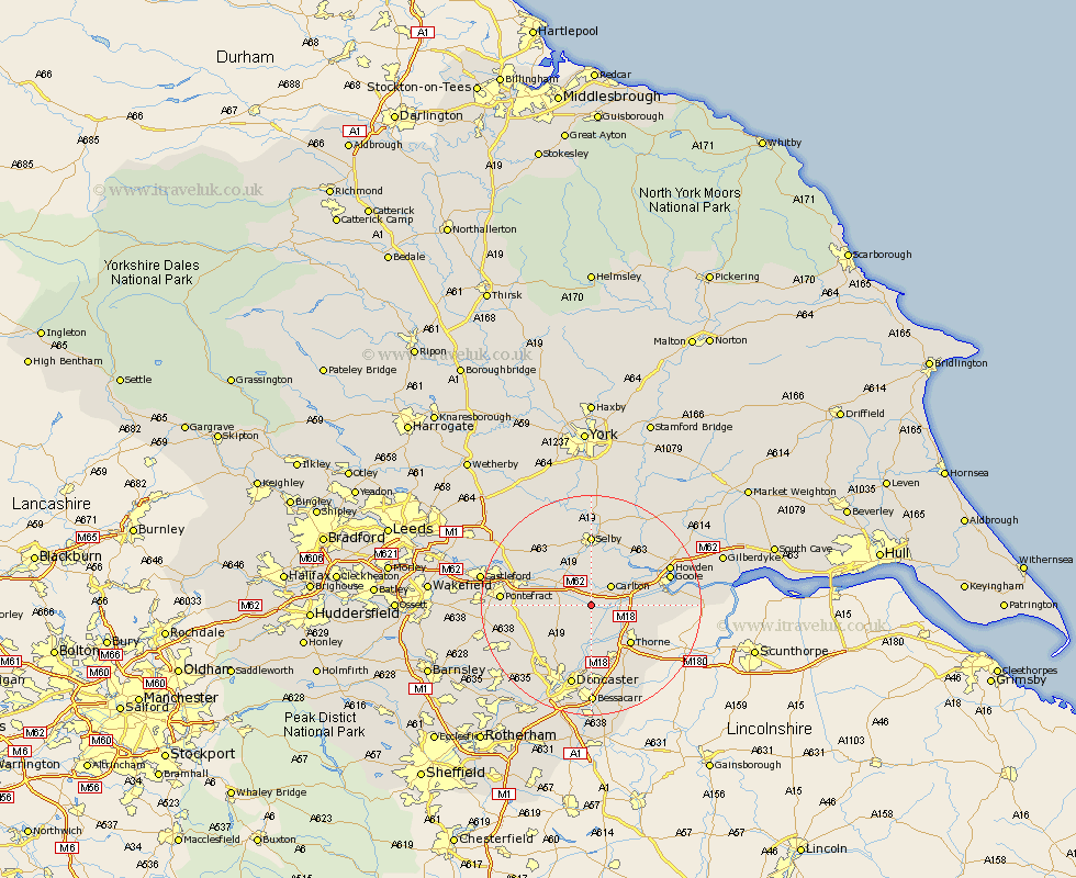
Yorkshire Map Showing Location of Pollington
Population: 939
Easting: 461660 Northing: 419343
Latitude: 53.67 Longitude: -1.07
 = Pollington
Easting: 461660 Northing: 419343
Latitude: 53.67 Longitude: -1.07
= Pollington
This Pollington map below is supplied by Google. Use the tools in the top left corner to zoom into street level or zoom out for a road map, you may also need to zoom in to see Pollington on the map. Click and drag the map to move around. If the map fails to load try and refresh your browser or zoom in or out (+ or -).
Update - it seems Google no longer allow people to use their maps for free! This Pollington map sometimes loads and sometimes gives a error. I am working on a solution.
Closest 30 Towns or Cities to Pollington (Population over 500)
Snaith 2.87km Hensall 4.3km Carlton 4.96km Whitley 5.79km Askern 7.09km Stainforth 7.74km Rawcliffe 7.9km Fishlake 8.12km Norton 8.54km Campsall 9.49km Moorends 9.69km Barlow 9.83km Thorne 9.92km Sutton 9.92km Barnby Dun 11.12km Barnby Don 11.12km Brayton 11.17km Knottingly 11.58km Knottingley 11.58km Darrington 12.08km Airmyn 12.3km Cliff Common Station 12.4km Cliffe Common 12.4km Hemingbrough 12.4km Hatfield 12.4km Hambleton 12.92km Selby 12.97km Kirk Sandall 13.02km North Elmsall 13.3km Carcroft 13.52km