Yorkshire Map Showing Location of Middleton On The Wolds
Easting: 495186 Northing: 449571
Latitude: 53.93 Longitude: -0.55
 = Middleton On The Wolds
Latitude: 53.93 Longitude: -0.55
= Middleton On The Wolds
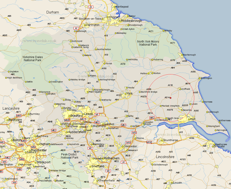
This Middleton On The Wolds map below is supplied by Google. Use the tools in the top left corner to zoom into street level or zoom out for a road map, you may also need to zoom in to see Middleton On The Wolds on the map. Click and drag the map to move around. If the map fails to load try and refresh your browser or zoom in or out (+ or -).
Update - it seems Google no longer allow people to use their maps for free! This Middleton On The Wolds map sometimes loads and sometimes gives a error. I am working on a solution.
Closest 30 Towns or Cities to Middleton On The Wolds (Population over 500)
Lockington 5.72km North Frodingham 5.73km Wetwang 7.5km Cranswick 7.86km Cherry Burton 8.1km Leckonfield 9.89km Leconfield 9.89km Market Weighton 10.64km Driffield 11.17km Bishop Burton 11.59km Pocklington 13.09km Tickton 13.19km Beverley 14.14km Nafferton 14.31km Leven 16.26km Brandesburton 16.47km Brandsburton 16.47km Woodmansey 16.96km Barmby on the Moor 17.46km Barmby-on-the-Moor 17.46km Barmby 17.46km Skidby 17.55km Kilham 17.66km Holme upon Spalding Moor 18.04km Holme 18.04km South Cave 18.81km Beeford 18.91km Fangfoss 18.91km Willerby 19.65km North Cave 19.65km