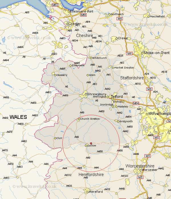
Shropshire Map Showing Location of Middleton
District: South Shropshire
Easting: 353495 Northing: 276402
Latitude: 52.38 Longitude: -2.68
 = Middleton
Easting: 353495 Northing: 276402
Latitude: 52.38 Longitude: -2.68
= Middleton
This Middleton map below is supplied by Google. Use the tools in the top left corner to zoom into street level or zoom out for a road map, you may also need to zoom in to see Middleton on the map. Click and drag the map to move around. If the map fails to load try and refresh your browser or zoom in or out (+ or -).
Update - it seems Google no longer allow people to use their maps for free! This Middleton map sometimes loads and sometimes gives a error. I am working on a solution.
Closest 30 Towns or Cities to Middleton (Population over 500)
Bitterley 2.93km Ludlow 3.86km Caynham 3.87km Diddlebury 9.55km Craven Arms 11.59km Cleobury Mortimer 13.57km Wistanstow 14.62km Rushbury 15km Ditton Priors 15.2km Bucknell 18.2km Kinlet 18.47km Church Stretton 20.15km North Lydbury 20.32km Lydbury North 20.32km Highley 21.66km Alveley 23.79km Clun 24.03km Bridgnorth 24.59km Much Wenlock 25.73km Cressage 28.16km Barrow Bridge 28.21km Barrow 28.21km Worfield 28.35km Broseley 29.27km Berrington 29.68km Condover 30km Shelve 30.12km Claverley 30.87km Ironbridge 31.43km Baystonhill 31.83km