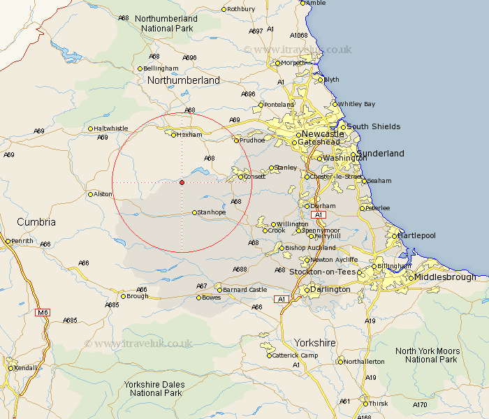
Durham Map Showing Location of Hunstanworth
Population: 133
District: Wear Valley
Easting: 395717 Northing: 548731
Latitude: 54.83 Longitude: -2.07
 = Hunstanworth
District: Wear Valley
Easting: 395717 Northing: 548731
Latitude: 54.83 Longitude: -2.07
= Hunstanworth
This Hunstanworth map below is supplied by Google. Use the tools in the top left corner to zoom into street level or zoom out for a road map, you may also need to zoom in to see Hunstanworth on the map. Click and drag the map to move around. If the map fails to load try and refresh your browser or zoom in or out (+ or -).
Update - it seems Google no longer allow people to use their maps for free! This Hunstanworth map sometimes loads and sometimes gives a error. I am working on a solution.
Closest 30 Towns or Cities to Hunstanworth (Population over 500)
Stanhope 9.8km Castleside 12.81km Consetti 15.06km Consett 15.06km Leadgate 17.47km Wolsingham 17.5km Tow Law 19.51km Cornsay 20.01km Annfield Plain 21.43km Lanchester 21.43km Rowlands Gill 23.26km Stanley 23.32km Burnopfield 23.59km Middleton in Teesdale 24.11km Esh 24.15km Langley Park 25.89km Crook 26.02km Willington 26.85km Whickham 26.92km Ushaw Moor 27.27km Blaydon 27.74km Edmondsley 27.81km Witton Gilbert 28.01km High Etherley 28.79km Etherley 28.79km Sacriston 28.89km Cockfield 29.55km Ouston 29.86km Ouston Moor 29.86km Pelton 30.1km